Puerto Vallarta Gustavo Diaz Ordaz International Airport (PVR)
Orientation and Maps
(Puerto Vallarta, Mexico)
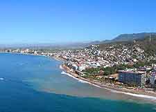
With a population of more than 220,000 inhabitants, the city of Puerto Vallarta can be found along the western coastline of Mexico, in the Jalisco province. Regularly attracting in excess of 2.5 million visitors every year, Puerto Vallarta is famous for its stunning beach resorts and waterfront areas.
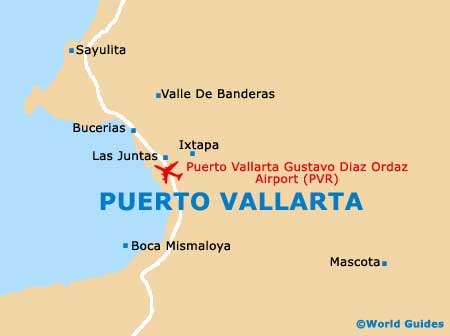
On the northern side of the city you will find the busy transport hub that is Puerto Vallarta Gustavo Diaz Ordaz International Airport (PVR). Tourism has become the main industry in this area of Mexico and visitors are always welcomed. Many people in the city are bilingual, speaking both Spanish and English.
Puerto Vallarta Gustavo Diaz Ordaz International Airport (PVR) Maps: Important City Districts
Not that long ago, Puerto Vallarta was a fairly small fishing village and has been transformed in recent years by the arrival of enormous blocks of tourist resorts, many of which line the coast. However, those looking for history will find many remnants of the past, such as cobbled streets and charming white-washed buildings with red-tiled roofs, being particularly concentrated throughout the old town area of Puerto Vallarta, known as the Zona Centro. This historic district is located alongside the Cuale River, with bridges linking either side.
Based around the Bay of (Bahia de Banderas), Puerto Vallarta features a backdrop of green mountains and lies on the southern side of the River Ameca. The region's many luxury hotels are sited in an area referred to as the 'Zona Hotelera', close to the airport and the Mariva Vallarta, with further resorts and beaches to the south.
Mexico Map

Puerto Vallarta Map